DataMade is a data and web consultancy for civic society.
We support our partners in working toward democracy, justice, and equity.

Partner with us!
DataMade helps governments, nonprofits, researchers, and journalists capture, organize, understand, and share data.
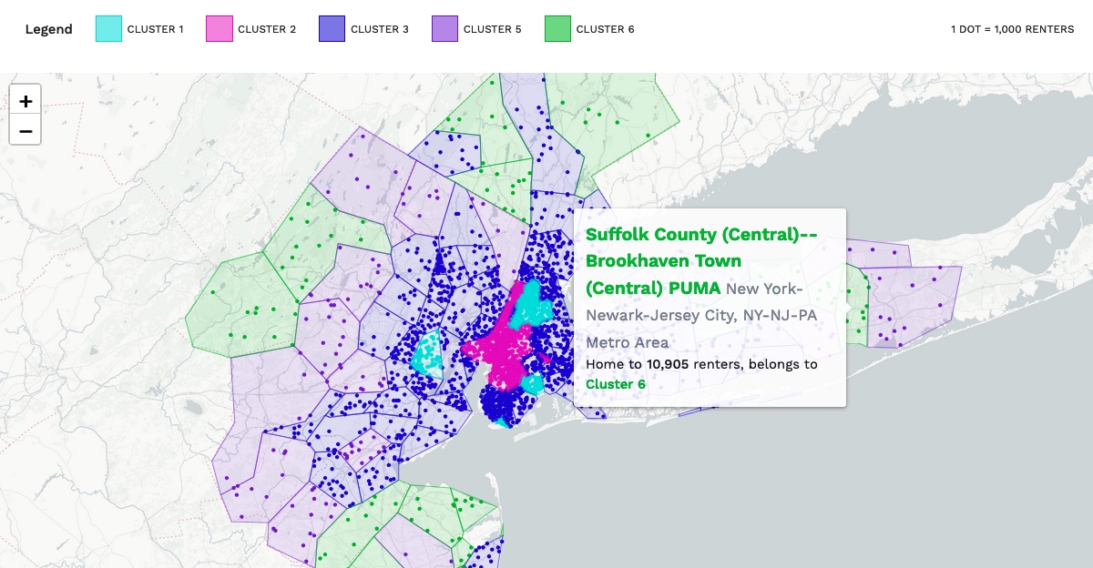
Preserving Naturally Occurring Affordable Housing
Partnership with The Preservation Compact, DePaul Institute for Housing Studies
A mapping tool designed to facilitate evidence-based decision-making in preservation strategies for affordable multifamily rental housing.
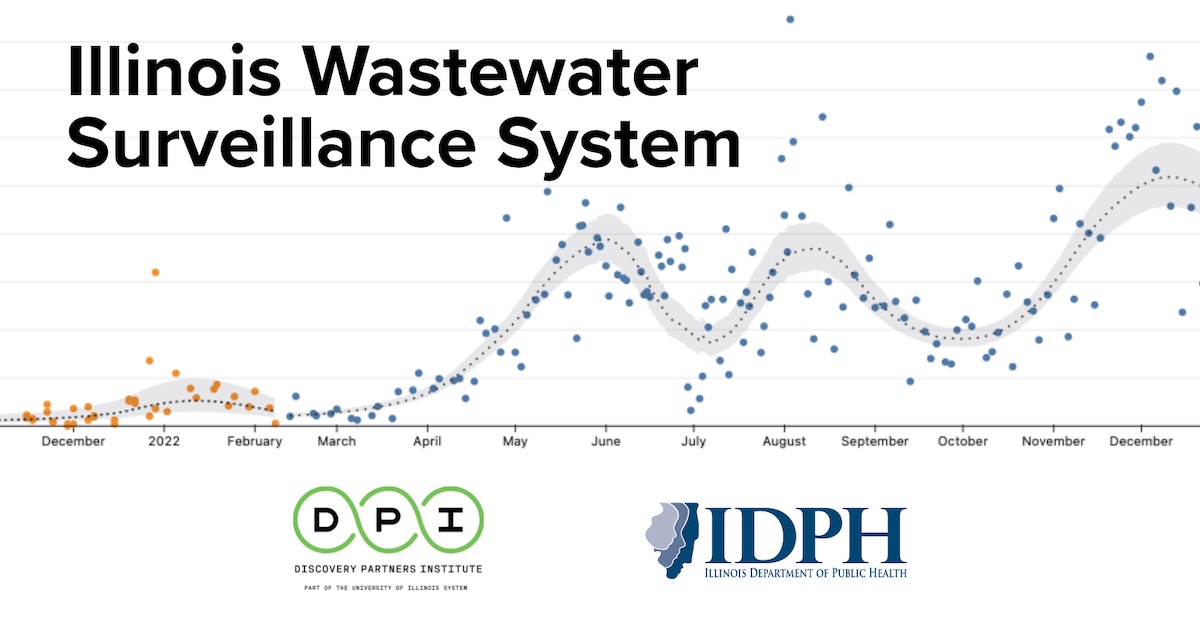
Illinois Wastewater Surveillance System
Partnership with Discovery Partners Institute and Illinois Department of Public Health
Provides series of COVID-19 measurements from wastewater for 75 sites across the state of Illinois.
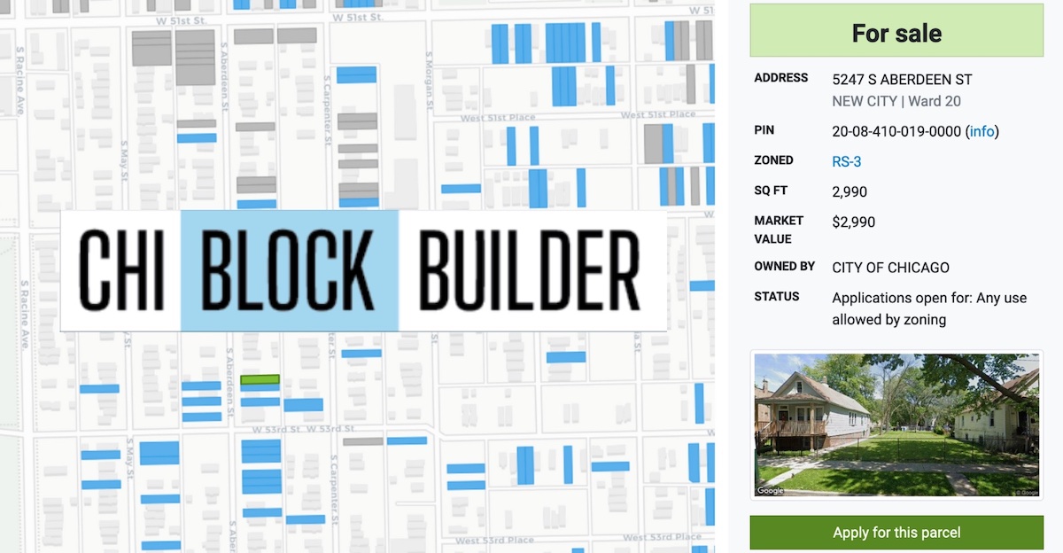
Partnership with City of Chicago - Department of Planning and Development
Browse all City-owned vacant surplus property in Chicago and apply to buy it.
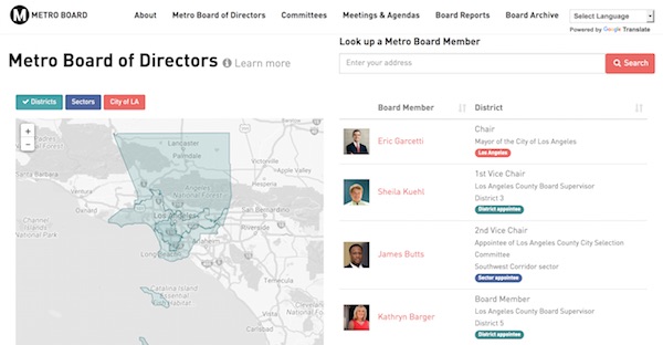
Los Angeles Metro Board Agendas
Partnership with Los Angeles County Metropolitan Transportation Authority
An open government tool for understanding and tracking the activity of the Board Members of the Los Angeles County Metropolitan Transportation Authority.
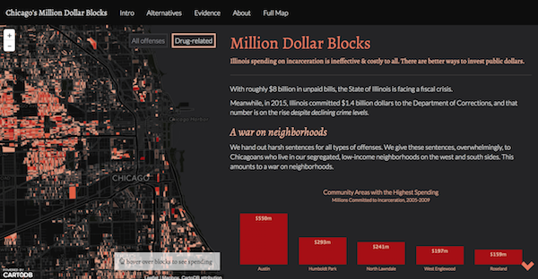
Chicago's Million Dollar Blocks
Pro bono
An interactive map showing spending on incarceration for every block in the City of Chicago.
Latest blog post
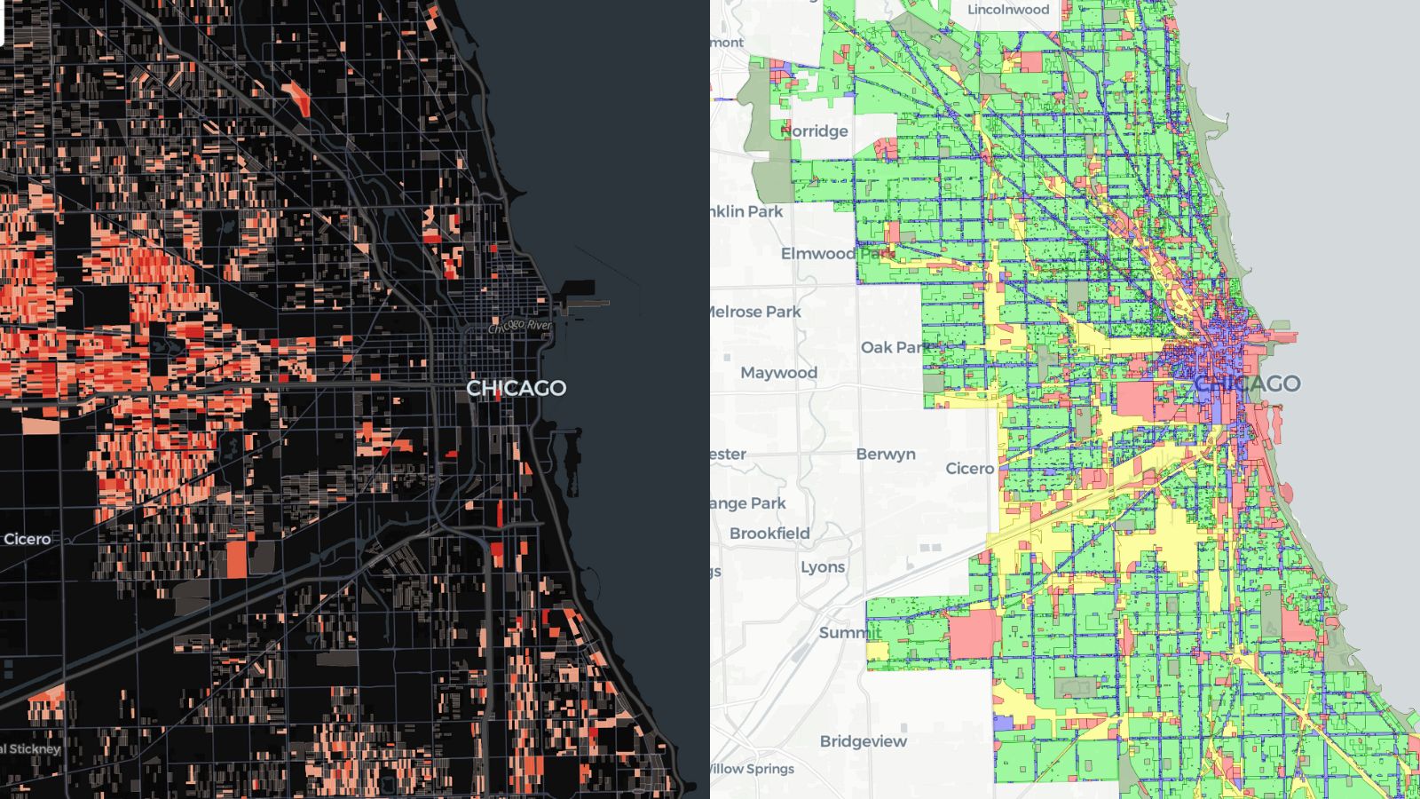
Modernizing our mapping stack with Maplibre
A significant reason for website failures is their reliance on external platforms, which frequently change or may even be shut down. However, a promising development in the past few years has been the emergence of GL-powered maps that operate entirely in the front-end browser. As a result, we have adopted Maplibre-gl as our preferred choice for data-rich maps and are in the process of transitioning many of our projects to this technology.